Description
Gintec G30+ IMU RTK GNSS Receiver adalah perangkat GNSS geodetik profesional yang menggabungkan teknologi multi-frekuensi satelit, IMU internal, dan fitur tilt (kemiringan) untuk memudahkan pengukuran di lapangan tanpa perlu penyejajaran vertikal yang rumit. Alat ini sangat cocok untuk aplikasi survei, pemetaan, konstruksi besar, pertambangan, maupun pemantauan lingkungan.
Linux intelligent system
Qualcomm Cortex-A7 + Linux, platform sistem cerdas menghadirkan komputasi efisien kepada penggunan dan perluasan fungsi produk tanpa batas.
Multi Constellation
GDengan 1408 Channels, G30Plus memberikan solusi navigasi waktu nyata yang sangat baik dengan akurasi tinggi. Semua sinyal GNSS (GPS, GLONASS, BDS, GALILEO, QZSS, SBAS) disertakan.
Adjustable Power
G30Plus memiliki radio internal dengan daya yang dapat disesuaikan sebesar 1W/5W. Dan ketika G30Plus bekerja sebagai base station dengan daya 5W, jarak transmisi dapat mencapai maksimal 16KM ketika bekerja di area terbuka.
Combined Antennas
Antena empat dalam satu yang baru mengintegrasikan GNSS, Wifi, Bluetooth, dan 4G, dengan volume lebih kecil dan sinyal lebih baik.
4G Modem
G30Plus memiliki modem 4G internal yang beroperasi dengan lebih banyak sinyal jaringan seluler. Koneksi internet yang dijamin cepat.
Long Endurance
Baterai lithium berkapasitas tinggi yang terpasang memastikan waktu kerja terus menerus lebih dari 20 jam dalam pengoperasian normal.
IP68 Design
Desain industri, cangkang paduan, magneisum padat, sesuai dengan persyaratan desain IP68, aman, dan andal.
SPECIFICATION
Hardware Qualcomm Cortex-A7
OS Linux
GNSS
Channels 1408
Satellites GPS: L1 C/A, L1C, L2P (Y), L2C, L5
GLONASS: G1, G2, G3*
BeiDou: B1I, B2I, B3I, B1C, B2a, B2b*
Galileo: E1, E5a, E5b, E6*
SBAS: L1
QZSS: L1, L2C, L5, L6*
IRNSS: L5*
Cold Start <20s
Initialization Time <5s
Initialization Reiability >99.9%
POSITIONING Accuracy
Single (RMS) Horizontal:1.5m Vertical : 2.5m
DGPS (RMS) Horizontal:0.4m Vertical : 0.8m
RTK (RMS) Horizontal:±(8mm+1ppm)
Vertical:±(15mm+1ppm)
Time Accuracy (RMS) 20ns
Static Accuracy (RMS) Horizontal:±(2.5mm+0.5ppm)
Vertical:±(5mm+0.5ppm)
Speed Accuracy (RMS)0.03m/s
Tilt Compensation Accuracy (within 60°) <= 2cm
SYSTEM
Bluetooth BR+EDR+BLE
WIFI 802.11 b/g/n
Mobile Network LET FDD: B1/2/3/4/5/7/8/12/13/18/19/20/25/26/28
LET TDD: B38/39/40/41
WCDMA: B1/2/B5/B8
GSM:850/900/1800/1900MHZ
Internal UHF RF transmit power: 1W/5W
Frequency: 410~470MHz
WAir baud rate : 9600/19200bps
Protocol SOUTH, Trim Talk, TRIMMK3, TRANSOET
Storage 32GB, User Storage Space 24GB
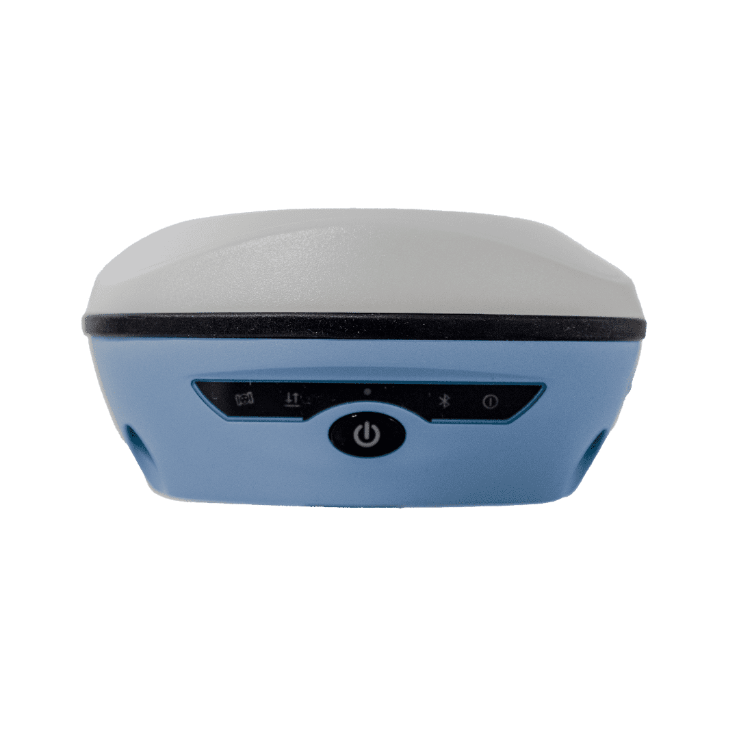
INDICATOR
Power indocator Show power status
Bluetooth indocator Show bluetooth status
Network indocator Show network signal status
Satellite indocator Show satellite status
Data link indocator Show differential signal status
POWER
Battery 6500mAh, 7.4V
Worktime More than 18 hours (Typical, Rover, GSM)
The static working modesupports continuous data collection for 26 hours under full power
Charge USB PD 15V/2A 5V/3A Support fast charging adapter adaptively and dynamically adjust charging current
ENVIRONMENT
Work Temperature –20 °C~+60 °C
Storage Temperature –30 °C~+85 °C
Waterproof/Dustproof IP68 Standard
Shock and Vibration Withstand 1.5 meters pole drop
Physical
Material Magnesium aluminum alloy main body, ABS/PC top cover
Dimension 143.5mm (Diameter)x90.7mm (Height)
Weight 924.5g
PAKET SUDAH TERMASUK:
- 1x G30+ Base
- 1x G30+ Rover
- 1x Controller
- 1x External Radio TRU 35
- 1x Surpad
- 1 unit pole carbon
- 2 unit tripod
- 1 unit tribrach
- 1 unit rotating GPS Adapter
- 1 unit pole extention