
Description
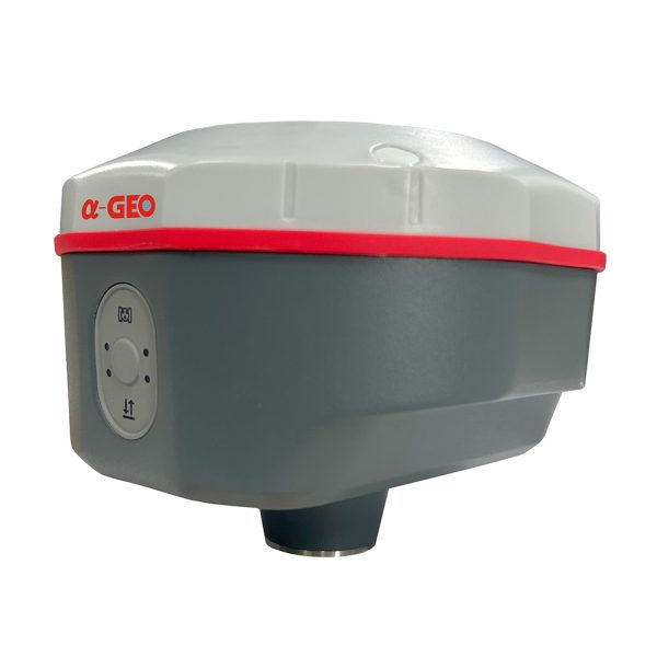
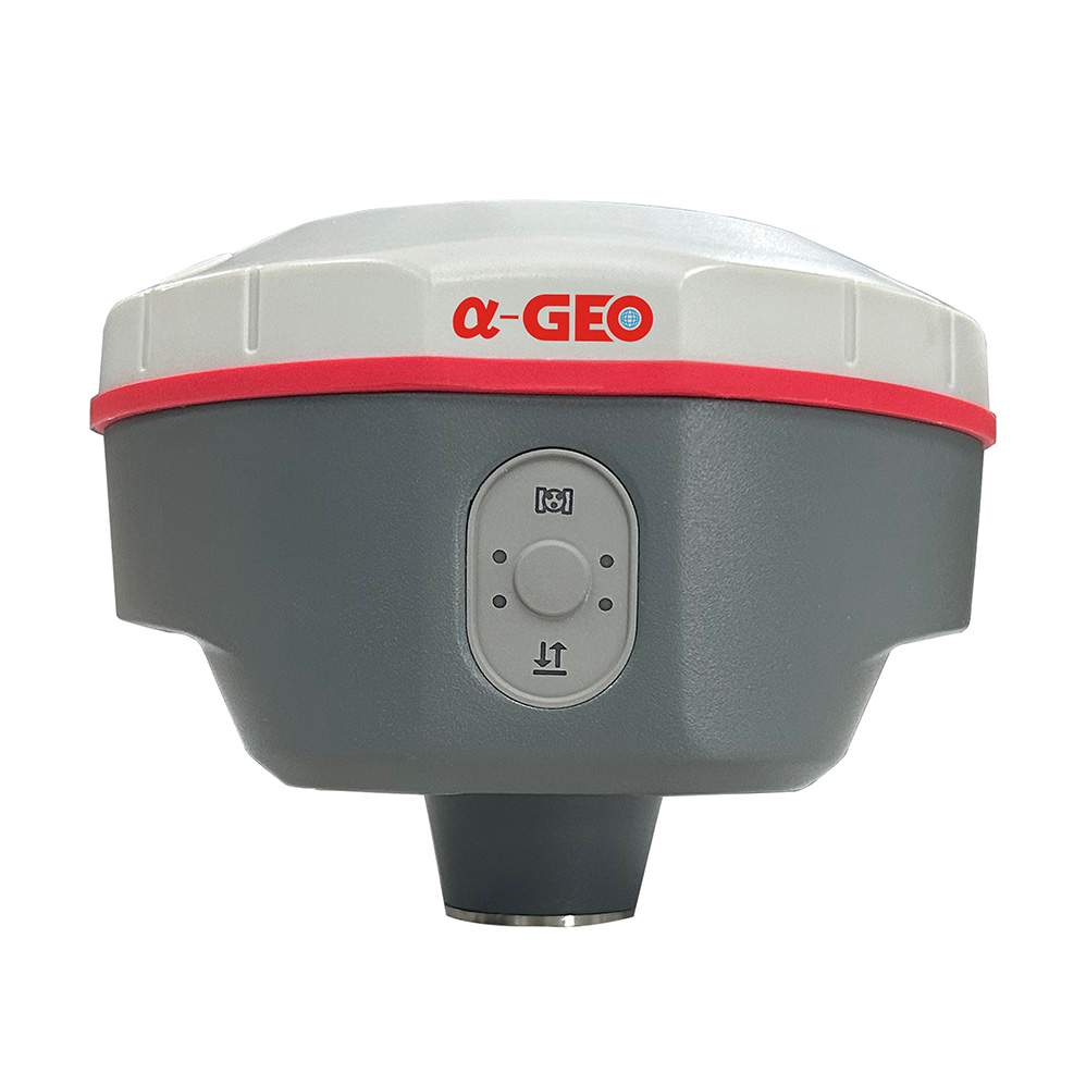
GPS RTK Alpha GEO Matrix II Lite (Include Radio External) adalah alat ukur GNSS RTK profesional yang dirancang untuk memberikan hasil pengukuran cepat, akurat, dan stabil di berbagai kondisi lapangan. Dengan dukungan teknologi multi-konstelasi satelit dan radio eksternal bawaan, perangkat ini siap digunakan untuk survei geodetik, konstruksi, pemetaan topografi, serta pengukuran tanah dengan efisiensi tinggi.
Super IMU, ucapkan selamat tinggal pada inisialisasi berulang
Matrix II dilengkapi dengan inisialisasi cepat, bebas kalibrasi, dan kebal terhadap gangguan magnetik Unit Pengukuran Inersia (IMU). Semua pengguna dapat menggunakan teknologi ini untuk mengumpulkan atau menandai titik-titik topo hingga 120°
MULTI KONSTELASI
Matrix II dengan chipset GNSS generasi baru dengan 1408 saluran yang mampu mendukung beberapa konstelasi satelit termasuk GPS, GLONASS, BEIDOU, GALILEO, OZSS, SBAS, dan IRNSS memberikan data spasial yang tepat dan akurat untuk semua pengguna di seluruh dunia.
SSD 64 GB Penyimpanan bebas khawatir
Memori internal 64 GB, yang dapat memenuhi sebagian besar kebutuhan kerja lapangan. Dan fitur penyimpanan siklik membantu penerima untuk secara otomatis menghapus
data observasi sebelumnya saat tidak ada cukup ruang di memori, dengan kinerja yang luar biasa ini, penyimpanan data dapat bertahan hampir 4 tahun berdasarkan interval pengambilan sampel 5 detik. Dan desain chip memori tertanam dapat memastikan keamanan data observasi.
SPESIFIKASI Alpha GEO Matrix ll Lite
| Performance specification | |
| Satellite signals tracked simultaneously | GPS: L1C/A, L1C, L2P(Y), L2C, L5 |
| GLONASS: L1, L2, L3 | |
| BEIDOU: B1I, B2I, B3I, B1C, B2a, B2b | |
| GALILEO: E1, E5a, E5b,E6 | |
| QZSS: L1, L2, L5, L6 | |
| SBAS: L1, L5 | |
| IRNSS: L5 | |
| Channels | 1408 tracking Channels |
| Cold start | <60 s |
| Hot start | <15 s |
| Positioning output rate | 1Hz – 20Hz |
| Signal Reacquisition | <1s |
| RTK Initialization time | <10s |
| Initialization Reliability | >99.99% |
| Time accuracy | 20 ns |
| Positioning | |
| Code differential GNSS positioning | Horizontal: 0.25 m + 1 ppm RMS Vertical: 0.50 m + 1 ppm RMS SBAS differential positioning accuracy²: typically <5m 3DRMS |
| Static GNSS surveying | Horizontal: 2.5 mm + 0.5 ppm RMS Vertical: 5 mm + 0.5 ppm RMS |
| Real Time Kinematic Surveying | |
| Single Baseline < 30 KM | Horizontal: 8 mm + 1 ppm RMS Vertical: 15 mm + 1ppm RMS |
| Network RTK | Horizontal: 8 mm + 0.5 ppm RMS Vertical: 15 mm + 0.5 ppm RMS |
| Laser survey | ±1cm + 5mm/m ( Tilt height less than 30° ) |
| Physical | |
| Material | Magnesium alloy |
| Dimensions | 120mm*72mm ( without bottom connector 20mm) |
| weight | 0.76kg |
| Operating temperature | -40°C to + 75°C |
| Storage temperature | -55°C to + 85°C |
| Protection IP | IP67 dust proof, protected from 30min immersion to depth of 1m |
| Shock | Survive a 2m pole drop onto concrete |
| Vibration | MIL-STD-810G |
| Humidity | 100%, condensing |
| Power Supply | |
| Battery | Power: 9~24V DC external power input on 5 pin LEMO port |
| Support USB Type-C fast charging | |
| Internal 7000mAh-7.4V lithium-ion battery | |
| Battery Life | |
| Rover Mode: 12 hours | |
| Base Mode: 7 hours | |
| Static Mode: 15 hours | |
| Communication & Data Storage | |
| I/O interface | LEMO port (5pin) Supports power input, serial port control, and external radio communication |
| USB Type-C port Data download / Charging | |
| Sim card slot Supports Nano-SIM | |
| Antenna port UHF antenna interface | |
| Radio modem | Transmit power 1/1.5w switchable |
| Frequency band 410MHz-470MHz; supports to set the frequency | |
| Protocols TrimTalk450s, SOUTH, Satel,PCC-EOT | |
| Cellular | Integrated full frequency multi band 4G modem, supports WCDMA/CDMA2000/TDD-LTE/FDD-LTE |
| WIFI | 802.11 b/g standard, access point & client mode, supports access to hotspot for correction transmission |
| Bluetooth | Bluetooth 5.2 Classical/BLE Proprietary double-mode |
| Data format | RTCM2x, RTCM3x, CMR & CMR+, sCMRx |
| RINEX, NMEA outputs | |
| Storage | 64GB internal memory, supports cyclic storage; with ability to collect over one year raw observation based on 5 seconds interval |
| Camera | |
| AR | – |
| Laser assisted | – |
| System integration | |
| OS system | Intelligent LINUX operating system |
| Tilt Compensation | IMU up to 120°(Calibration free) |
| Supported controllers | All android devices with supported software |
| Design | |
| Button | Power key |
| Indicator | Power indicator, data link indicator, satellite indicator, Bluetooth indicator |
| Voice | Intelligent voice prompts |
| WEBUI | Support WEBUI configuration |
PAKET SUDAH TERMASUK:
- 1x Controller S50III Set
- 1x Radio External Set
- 1x Permanent Software Supro6.0
- 1x Carbon Pole
- 2x Tripod 1x Tribrach Adapter


